
Maillebois
Maillebois | |
|---|---|
 The chateau in Maillebois | |
 Coat of arms | |
Location of Maillebois  | |
 Maillebois  Maillebois | |
| Coordinates: 48°37′48″N 1°08′57″E / 48.63°N 1.1492°E | |
| Country | France |
| Region | Centre-Val de Loire |
| Department | Eure-et-Loir |
| Arrondissement | Dreux |
| Canton | Saint-Lubin-des-Joncherets |
| Intercommunality | Communauté d'agglomération du Pays de Dreux |
| Government | |
| • Mayor (2014–2020) | Christian Maisons |
| Area 1 | 41 km2 (16 sq mi) |
| Population (2021)[1] | 911 |
| • Density | 22/km2 (58/sq mi) |
| Time zone | UTC+01:00 (CET) |
| • Summer (DST) | UTC+02:00 (CEST) |
| INSEE/Postal code | 28226 /28170 |
| Elevation | 137–191 m (449–627 ft) (avg. 165 m or 541 ft) |
| 1 French Land Register data, which excludes lakes, ponds, glaciers > 1 km2 (0.386 sq mi or 247 acres) and river estuaries. | |
Maillebois is a commune in the Eure-et-Loir department in northern France. The Blaise, a tributary of the Eure, runs through the town.
Population
| Year | Pop. | ±% |
|---|---|---|
| 1962 | 1,040 | — |
| 1968 | 770 | −26.0% |
| 1975 | 843 | +9.5% |
| 1982 | 828 | −1.8% |
| 1990 | 821 | −0.8% |
| 1999 | 917 | +11.7% |
| 2008 | 990 | +8.0% |
| 2016 | 930 | −6.1% |
Interesting places
- Chateau de Maillebois, a registered monument[2]
- Rouvray farm, a former Chateau Fort (which is a fortified building, like a fortress, but often also a practical building) and registered monument.[3] It was a fort during the Hundred Years' War.
- Les Forges de Dampierre-sur-Blévy, a former foundry and a registered monument[4]
- Dreux-Louvilliers Air Base is a former United States Air Force base near Maillebois
Famous residents
- Jean-Baptiste Francois des Marets, marquis of Maillebois, was a Marshal of France.
- Paul-Félix Armand-Delille, bacteriologist who introduced the myxomatosis virus in his estate of the château.
- Hubert Latham lived in the Chateau de Maillebois (the family home)
See also
Gallery
-
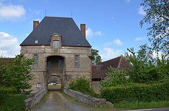 Rouvray farm
 -
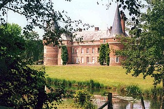 Chateau de Maillebois
 -
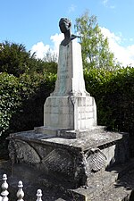 Bust of Hubert Latham in the town centre.
 -
 Aerial photograph of Dreux-Louvilliers Air Base
 -
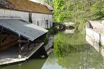 The Blaise in Maillebois


.jpg)

.jpg)
References
- ^ "Populations légales 2021" (in French). The National Institute of Statistics and Economic Studies. 28 December 2023.
- ^ Chateau de Maillebois on the Base Merimee website
- ^ Rouvray farm on the Base Merimee website
- ^ Les Forges de Dampierre-sur-Blévy on the Base Merimee website
External links
Wikimedia Commons has media related to Maillebois.
| International | |
|---|---|
| National | |
| Geographic | |
This Eure-et-Loir geographical article is a stub. You can help Wikipedia by expanding it. |