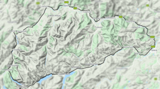
Manor Hills

The Manor Hills, also known as the Tweedsmuir Hills, are a range of hills south of Peebles in the Scottish Borders, one of the ranges which collectively form the Southern Uplands. The highest point of the range is Broad Law, which is also the highest point in the historic county of Peeblesshire. The hills contain five Marilyns and thirteen Donalds, of which there is one Graham and one Corbett.[1] They are separated from the Moffat Hills by the Talla Reservoir, Megget Reservoir and St. Mary's Loch, the Moorfoot Hills by the A72 and the Culter Hills in South Lanarkshire by the A701. The western portion of the hills are designated as the 'Tweedsmuir Hills' Site of Special Scientific Interest and the 'Upper Tweeddale' National Scenic Area, with the major tributary rivers designated as Special Areas of Conservation. [2]
References
- ^ "The Donalds (Walkhighlands)". www.walkhighlands.co.uk.
- ^ https://sitelink.nature.scot/map
