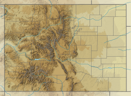
Smith Reservoir (Costilla County, Colorado)
Appearance
| Smith Reservoir | |
|---|---|
 Looking across the reservoir towards Blanca Peak | |
| Location | Costilla County, Colorado |
| Coordinates | 37°23′34″N 105°31′50″W / 37.39278°N 105.53056°W[1] |
| Type | reservoir |
| Primary inflows | Trinchera Creek Sangre de Cristo Creek Ute Creek and several other smaller creeks |
| Primary outflows | Trinchera Creek |
| Managing agency | Trinchera Irrigation Company[2] |
| Designation | Smith Reservoir State Wildlife Area |
| Built | 1914[3] |
| Water volume | 14,058 acre⋅ft (17,340,000 m3)[3] |
| Surface elevation | 7,716 ft (2,352 m)[1] |
| Frozen | Freezes in winter |
Smith Reservoir is located in Costilla County, Colorado, south of Blanca in the San Luis Valley. The reservoir is owned by the Trinchera Irrigation Company.[2]
Dam
The rockfill dam, Smith Dam,[4] was built in 1914 and — according to the National Inventory of Dams — stores 14,058 acre⋅ft (17,340,000 m3) of water.[3] It impounds Trinchera Creek. Sangre de Cristo Creek and several smaller creeks also flow into the reservoir; prior to the reservoir's construction, Sangre de Cristo Creek had its confluence with Trinchera Creek here.
State wildlife area
The lake and the land immediately surrounding it are also designated as the Smith Reservoir State Wildlife Area. It offers trout fishing, waterfowl hunting, and camping.[5]
References
- ^ a b "Smith Reservoir". Geographic Names Information System. United States Geological Survey, United States Department of the Interior.
- ^ a b The Trinchera Irrigation Company at the Wayback Machine (archived 5 August 2018)
- ^ a b c "Smith Dam". National Inventory of Dams. U.S. Army Corps of Engineers. 2018-07-12. Retrieved 2020-06-07.
- ^ "Smith Dam". Geographic Names Information System. United States Geological Survey, United States Department of the Interior.
- ^ "Smith Reservoir State Wildlife Area" (PDF). Colorado Parks & Wildlife. 2019-03-05. Retrieved 2020-06-07.
External links

