Jump to content

Oploo

Coordinates: 51°36′32″N 5°52′25″E / 51.60889°N 5.87361°E / 51.60889; 5.87361
From Wikipedia, the free encyclopedia

This is an old revision of this page, as edited by CommonsDelinker (talk | contribs) at 22:41, 7 June 2020 (Replacing 1865_Oploo.gif with File:1865_Oploo.png (by CommonsDelinker because: redirect linked from other project).). The present address (URL) is a permanent link to this revision, which may differ significantly from the current revision.

Oploo
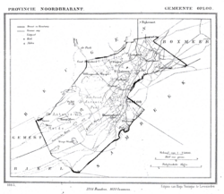
Oploo in 1865
Oploo in 1865
Coordinates: 51°36′32″N 5°52′25″E / 51.60889°N 5.87361°E / 51.60889; 5.87361
CountryNetherlands
ProvinceNorth Brabant
MunicipalitySint Anthonis
Population
 (2005)
1,806

Oploo is a village in the Dutch province of North Brabant. It is located in the municipality of St. Anthonis.

Oploo was a separate municipality until 1821, when it merged with Sint Anthonis en Ledeacker to form the new municipality of Oploo, Sint Anthonis en Ledeacker.[1]

References

  1. ^ Ad van der Meer and Onno Boonstra, "Repertorium van Nederlandse gemeenten", KNAW, 2006. [1]