Capelle
Appearance
Capelle | |
|---|---|
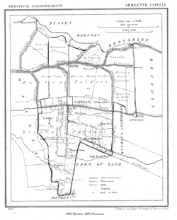
 Capelle in 1867 | |
| Coordinates: 51°41′32″N 4°59′7″E / 51.69222°N 4.98528°E | |
| Country | Netherlands |
| Province | North Brabant |
| Municipality | Waalwijk |
| Area | |
| • Total | 20.05 km2 (7.74 sq mi) |
| Population (2008) | 3,000 |
Capelle is a village in the Dutch province of North Brabant. It is located about 6 km west of Waalwijk.
Capelle was a separate municipality until 1923, when it merged with Sprang and Vrijhoeve-Capelle. They formed the new municipality of Sprang-Capelle, which existed until 1997. Since 1997 Capelle is part of the municipality of Waalwijk.[1]
References
- ^ Ad van der Meer and Onno Boonstra, Repertorium van Nederlandse gemeenten, KNAW, 2011.
External links
- Template:Kuyper Map of the former municipality, around 1868.
- Pictures of the village of Capelle
