Col du Noyer
Appearance
| Col du Noyer | |
|---|---|
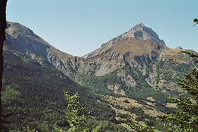
 Col du Noyer, seen from Champsaur. | |
| Elevation | 1,664 m (5,459 ft) |
| Traversed by | D 17 |
| Location | Hautes-Alpes, France |
| Range | Alps |
| Coordinates | 44°41′31″N 5°59′7″E / 44.69194°N 5.98528°E |
Col du Noyer (el. 1664 m.) is a high mountain pass in the Alps in the department of Hautes-Alpes in France.

Appearances in Tour de France
The pass was first included in the Tour de France in 1970 and has since featured 4 times, most recently in 2010.[1]
| Year | Stage | Category | Leader at the summit |
|---|---|---|---|
| 2010 | 10 | 2 | |
| 1982 | 15 | 2 | |
| 1971 | 11 | 2 | |
| 1970 | 13 | 1 |
See also
- Cycling Col du Noyer - Maps, Profiles, Photos
- List of highest paved roads in Europe
- List of mountain passes
References
- ^ "Le col du Noyer dans le Tour de France". ledicodutour.com. Retrieved 14 July 2010.
