Coylet
Appearance
Coylet
| |
|---|---|
 Coylet Inn | |
Location within Argyll and Bute | |
| OS grid reference | NS 14304 88632 |
| Council area |
|
| Lieutenancy area |
|
| Country | Scotland |
| Sovereign state | United Kingdom |
| Post town | DUNOON, ARGYLL |
| Postcode district | PA23 |
| Dialling code | 01369 |
| UK Parliament |
|
| Scottish Parliament |
|

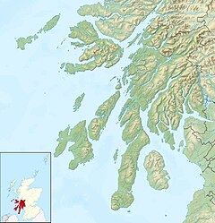
Coylet is a hamlet on Loch Eck, Cowal peninsula, Argyll and Bute, in West Scotland.[1]
The hamlet is within the Argyll Forest Park, which is itself within the Loch Lomond and The Trossachs National Park. It developed around the Coylet Inn, a coaching inn on the A815 road that leads to Dunoon, the main town on the peninsula.
The name may be derived from Gaelic caol ait, "narrow place".[2]
References
- ^ "Benmore Forest and Loch Eck - D-block GB-212000-687000". BBC Domesday Reloaded. British Broadcasting Corporation. Retrieved 4 February 2017.
- ^ James Brown Johnston (1903). "Place-names of Scotland. Coylet Inn (L. Eck)". Nature. 70 (1813) (2nd ed.): 85. Bibcode:1904Natur..70..292.. doi:10.1038/070292a0. OCLC 2204716.
External links
- Map sources for Coylet

