
Grafschaft (Schmallenberg)
Grafschaft | |
|---|---|
 | |
 Coat of arms | |
Location of Grafschaft  | |
 Grafschaft  Grafschaft | |
| Coordinates: 51°8′45″N 8°19′31″E / 51.14583°N 8.32528°E | |
| Country | Germany |
| State | North Rhine-Westphalia |
| Admin. region | Arnsberg |
| District | Hochsauerlandkreis |
| Town | Schmallenberg |
| Population (2019-12-31) | |
| • Total | 1,096 |
| Time zone | UTC+01:00 (CET) |
| • Summer (DST) | UTC+02:00 (CEST) |
Grafschaft is a locality in the municipality Schmallenberg in the High Sauerland District in North Rhine-Westphalia, Germany.
The village has 1096 inhabitants[1] and lies in the east of the municipality of Schmallenberg at a height of around 410 m. The river Grafschaft flows through the village. Grafschaft borders on the villages of Schmallenberg, Gleidorf, Winkhausen, Almert, Störmecke and Latrop.
In 1072 a Benedictine monastery of Grafschaft was founded in Grafschaft on a site at the foot of the Wilzenberg mountain, by St. Anno II, Archbishop of Cologne.[2] The village used to belong to the municipality of Grafschaft in Amt Schmallenberg until the end of 1974.
Gallery
-
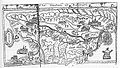
 „Gravelcop“ 1645 - Westphalia Ducatus (Duchy of Westphalia)
 -
 Vogtei Grafschaft, 1697
 -
 Grafschaft, 1903
 -
 St. Georg Church, 1963


External links
References
- ^ Schmallenberg.de: Inhabitants (in German)
- ^ Karl Hopf: Grafschaft (Dynasten und Kloster), S. 213 ff. (Google-Books) in J. S. Ersch, J. G. Gruber: Allgemeine Encyclopädie der Wissenschaften und Künste, Erste Section, A–G, Brockhaus, Leipzig, 1864
| Authority control databases: National |
|---|