Jump to content

Ixtlahuacán

Coordinates: 18°59′52″N 103°44′09″W / 18.99778°N 103.73583°W / 18.99778; -103.73583
From Wikipedia, the free encyclopedia

This is an old revision of this page, as edited by Telephone Directory (talk | contribs) at 01:41, 14 July 2020. The present address (URL) is a permanent link to this revision, which may differ significantly from the current revision.

Ixtlahuacán
Coat of arms of Ixtlahuacán
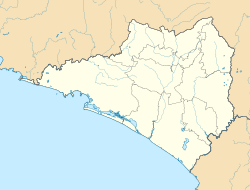
Ixtlahuacán is located in Colima
Ixtlahuacán
Ixtlahuacán
Location in Mexico
Ixtlahuacán is located in Mexico
Ixtlahuacán
Ixtlahuacán
Ixtlahuacán (Mexico)
Coordinates: 18°59′52″N 103°44′09″W / 18.99778°N 103.73583°W / 18.99778; -103.73583
Country Mexico
StateColima
MunicipalityIxtlahuacán

Ixtlahuacán is a city and seat of the municipality of Ixtlahuacán, in the Mexican state of Colima.[1]

References

  1. ^ Instituto Nacional de Estadística y Geografía. Principales resultados por localidad 2005 (ITER). Retrieved on November 9, 2008