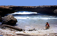
Aruba Natural Bridge
Appearance


The Aruba Natural Bridge was a tourist attraction in Aruba that was formed naturally out of coral limestone. It collapsed on September 2, 2005.
The natural arch, measuring approximately 25 feet (7.6 m) high and 100 feet (30 m) long, was the remnant of an ancient cave.[1]
References
- ^ Sullivan, Lynne M. (2006). "Adventure Guide to Aruba, Bonaire & Curaçao". Hunter Publishing, Inc. p. 80. Retrieved 15 December 2013.
External links
![]() Media related to Aruba Natural Bridge at Wikimedia Commons
Media related to Aruba Natural Bridge at Wikimedia Commons
12°32′28″N 69°57′30″W / 12.54111°N 69.95833°W
