
Qiemo River
The Qiemo River (Chinese: 且末河; pinyin: Qiěmò Hé), also called the Cherchen (Chinese: 车尔臣河; pinyin: Chē'ěrchén Hé; Wade–Giles: Ch'e-erh-ch'en Ho) or Qarqan River[1][2], runs across the Tarim Basin in the Xinjiang Uyghur Autonomous Region. It feeds into the Lop Nor salty marshes.
Historical maps
-
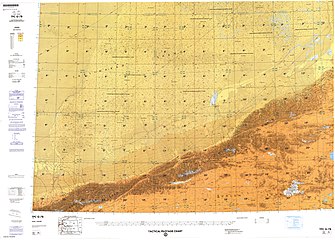
![Map including the river (labeled as Ch'e-erh-ch'en Ho) (DMA, 1980)[a]](//upload.wikimedia.org/wikipedia/commons/thumb/f/fb/Operational_Navigation_Chart_G-7%2C_6th_edition.jpg/331px-Operational_Navigation_Chart_G-7%2C_6th_edition.jpg)
-
 Map including the river (labeled as Qarqan He) (DMA, 1990)
![Map including the river (labeled as Ch'e-erh-ch'en Ho) (DMA, 1980)[a]](/wiki/File:Operational_Navigation_Chart_G-7,_6th_edition.jpg)

Notes
- ^ From map: "The representation of international boundaries is not necessarily authoritative."
References
- ^ Geographica: The complete illustrated Atlas of the world. 2005. p. 212. ISBN 1 7416 6036 X – via Internet Archive.
Qarqan
- ^ "Records of Xinjiang Ground-jay Podoces biddulphi in Taklimakan Desert, Xinjiang, China" (PDF). 2004. Retrieved 28 July 2020.
Qarqan River
See also
37°50′N 85°40′E / 37.833°N 85.667°E
This Xinjiang location article is a stub. You can help Wikipedia by expanding it. |
This article related to a river in China is a stub. You can help Wikipedia by expanding it. |