Murici
Appearance
Murici | |
|---|---|
 | |
| Coordinates: 9°18′25″S 35°56′34″W / 9.30694°S 35.94278°W | |
| Country | |
| State | Alagoas |
| Government | |
| • Prefect | Olavo Neto |
| Area | |
| • Total | 163.701 sq mi (423.983 km2) |
| Elevation | 269 ft (82 m) |
| Population (2010) | |
| • Total | 26,706[1] |
| Time zone | UTC-3 |
- For the tree and its fruit, see Nance.
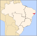
Murici is a municipality located in the east of the Brazilian state of Alagoas. Its population is 22,132 (2005) and its area is 424 km².[2] According to the Veja magazine,[3] despite receiving generous public transfers, the city still lags behind most municipalities in Brazil in human development. 30.6% of its inhabitants are illiterate and 65% rely on Federal funds to survive, which contribute for an HDI of just 0.58, slightly below Iraq's HDI of 0.59.[4]
The municipality contains 61% of the 6,116 hectares (15,110 acres) Murici Ecological Station, created in 2001.[5]
References
- ^ "Censo Populacional 2010". Censo Populacional 2010. Instituto Brasileiro de Geografia e Estatística (IBGE). 29 November 2010. Retrieved 11 December 2010.
- ^ IBGE - [1]
- ^ Jimenez, Gabriele (2013), "Parada no Tempo". Abril press, April 17th, 2013, pg. 88.
- ^ "Murici, a cidade onde a família Calheiros se reveza no poder". VEJA.com.
- ^ ESEC de Murici (ESEC) (in Portuguese), ISA: Instituto Socioambiental, retrieved 2016-11-06


