
Kodagahalli

12°22′37″N 76°49′27″E / 12.376966°N 76.824045°E Kodagahalli is a small village in Mysore district of Karnataka state, India.
Location
Kodagahalli is located between Bannur and Srirangapatna on Karighatta road.[1] [2][3]
See also
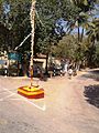
Image gallery
-
 Aravattikoppal
 -
 Cheehalli


References
- ^ https://www.google.co.in/maps/place/12%C2%B022'37.1%22N+76%C2%B049'26.6%22E/@12.3769712,76.8218563,17z/data=!3m1!4b1!4m5!3m4!1s0x0:0x0!8m2!3d12.376966!4d76.824045
- ^ http://www.mapsofindia.com/pincode/india/karnataka/mysore/kodagahalli.html
- ^ https://villageinfo.in/karnataka/mandya/pandavapura/s-kodagahalli.html