Veitatei
Appearance

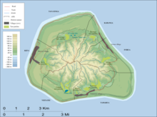
Veitatei is one of the six traditional districts of the island of Mangaia in the Cook Islands.[1] It is located in the south of the island, to the east of the District of Kei'a and west of the District of Tamarua. The district was previously called Patiki-enua-o-Rangi.[1]
References
- ^ a b Te Rangi Hiroa (1934). Mangaian Society. Honolulu: Bernice P. Bishop Museum. p. 126. Retrieved 9 August 2020 – via NZETC.
21°56′29.77″S 157°56′26.69″W / 21.9416028°S 157.9407472°W
