Moananui Islet
Appearance

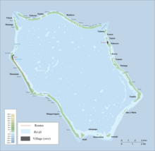
Moananui Islet is an islet in Penrhyn Atoll (Tongareva) in the Cook Islands.[1]
The main village of the atoll, Omoka, is situated on Moananui Islet. The islet has a small airstrip.
References
- ^ Liu Chuang; Shi Ruixiang; Chen Lijun (January 2019). "Penrhyn Atoll". Institute of Geographical Sciences and Natural Resources Research, Chinese Academy of Sciences. Retrieved 10 August 2020.
8°59′S 158°04′W / 8.983°S 158.067°W
