Pointe du Lac station
This article needs additional citations for verification. (February 2017) |
| Paris Métro station | |||||||||||
 | |||||||||||
| General information | |||||||||||
| Location | Créteil Île-de-France France | ||||||||||
| Coordinates | 48°46′08″N 2°27′53″E / 48.76889°N 2.46472°E | ||||||||||
| Owned by | RATP | ||||||||||
| Operated by | RATP | ||||||||||
| Other information | |||||||||||
| Fare zone | 1 | ||||||||||
| History | |||||||||||
| Opened | 8 October 2011 | ||||||||||
| Services | |||||||||||
| |||||||||||
| |||||||||||
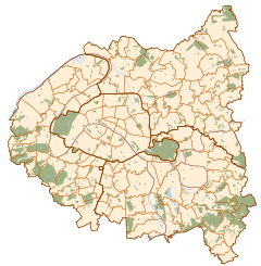
Pointe du Lac (French pronunciation: [pwɛ̃t dy lak]) is a station on line 8 of the Paris Métro in the commune of Créteil. It is the eastern terminus of the line and is on the surface. It opened on 8 October 2011 after a 1.3 km extension from Créteil - Préfecture.[1] It is the most easterly and southerly station on Paris Metro system (not including stations on RER lines). It is situated to the South East of Lac de Créteil.
Station layout
| Platform level | Westbound | ← |
| Island platform, doors will open on the left, right | ||
| Westbound | ← | |
| Eastbound | | |
| Side platform, doors will open on the right | ||
| 1F | Mezzanine |
| Street Level |
References
- ^ "La station de métro a transformé la Pointe-du-Lac". LeParisien. Retrieved 10 September 2015.

