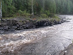
Jänisjoki
Appearance
You can help expand this article with text translated from the corresponding article in Finnish. (December 2009) Click [show] for important translation instructions.
|
| Jänisjoki, Yanisyoki | |
|---|---|
 | |
 | |
| Location | |
| Countries | |
| Physical characteristics | |
| Mouth | Lake Ladoga |
• coordinates | 61°42′34″N 30°59′37″E / 61.70944°N 30.99361°E |
| Length | 70 km (43 mi) |
| Basin size | 3,900 km2 (1,500 sq mi) |
| Basin features | |
| Progression | Lake Ladoga→ Neva→ Gulf of Finland |
Jänisjoki (Template:Lang-ru) is a river of Finland and Russia. It begins from the territory of Finland in the province of Northern Karelia, passes into the Republic of Karelia in Russia and flows there into Lake Ladoga. It is 70 kilometres (43 mi) long, and has a drainage basin of 3,900 square kilometres (1,500 sq mi).[1] It is part of the Neva River basin in Finland and Russia that flows into the Gulf of Finland in St. Petersburg, Russia.
See also
References
- ^ "Река Янисйоки (Янги-йоки, Янисъёки) in the State Water Register of Russia". textual.ru (in Russian).
