Epte
Appearance
| Epte | |
|---|---|
 Claude Monet's 1899 The Waterlily Pond, green harmony. Monet's Water Lilies series was created and inspired by diverting a branch of the Epte to a section of his gardens. | |
 | |
| Location | |
| Country | France |
| Physical characteristics | |
| Source | |
| • location | Normandy |
| • elevation | 190 m (620 ft) |
| Mouth | |
• location | Seine |
• coordinates | 49°3′40″N 1°31′42″E / 49.06111°N 1.52833°E |
| Length | 112.5 km (69.9 mi) |
| Basin size | 1,403 km2 (542 sq mi) |
| Discharge | |
| • average | 9.8 m3/s (350 cu ft/s) |
| Basin features | |
| Progression | Seine→ English Channel |
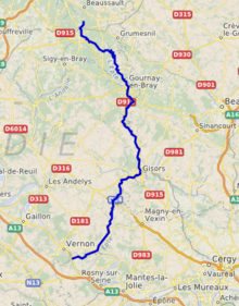
The Epte is a river in Seine-Maritime and Eure, in Normandy, France. It is a right tributary of the Seine, 112.5 km (69.9 mi) long.[1] The river rises in Seine-Maritime in the Pays de Bray, near Forges-les-Eaux. The river empties into the Seine not far from Giverny. One of its tributaries is the Aubette de Magny.
In 911 the Treaty of Saint-Clair-sur-Epte established the river as the historical boundary of Normandy and Île-de-France.
Claude Monet lived at Giverny near the river for more than forty years. In his garden, by diverting a branch of the Epte, he established a water garden with its famous water-lily pond and its Japanese-style bridge. The river appears in a number of his works, including Peupliers au bord de l'Epte.
References
External links
Wikimedia Commons has media related to Epte.
