Laurentina (Rome Metro)
Appearance
 | |||||||||||
| General information | |||||||||||
| Coordinates | 41°49′37″N 12°28′52″E / 41.82694°N 12.48111°E | ||||||||||
| Owned by | ATAC | ||||||||||
| Construction | |||||||||||
| Structure type | Underground | ||||||||||
| History | |||||||||||
| Opened | 1955 | ||||||||||
| Rebuilt | 1990 | ||||||||||
| Services | |||||||||||
| |||||||||||
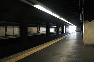
Laurentina is the southern terminus of Line B of the Rome Metro. It is in the Giuliano-Dalmata quarter at the crossroads of Via Laurentina, Via di Vigna Murata, Viale Luca Gaurico and Largo Vittime delle Foibe Istriane The first station on the site was begun in the 1930s, but only completed and opened in 1955. This was demolished in the 1980s, and the present building opened in 1990. It is also the terminus for several suburban bus routes.
Surroundings
- Sant'Eugenio Hospital
- Cecchignola
- Via Laurentina
- Via di Vigna Murata
- Tre Fontane Abbey
External links
![]() Media related to Metropolitana di Roma linea B - Laurentina at Wikimedia Commons
Media related to Metropolitana di Roma linea B - Laurentina at Wikimedia Commons

