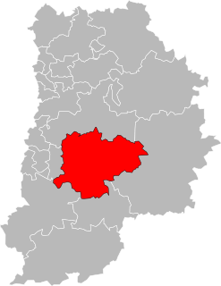
Canton of Nangis
Appearance
Nangis | |
|---|---|
 | |
| Country | France |
| Region | Île-de-France |
| Department | Seine-et-Marne |
| No. of communes | 46 |
| Seat | Nangis |
| Area | 579.85 km2 (223.88 sq mi) |
| Population (2017) | 60,097 |
| • Density | 104/km2 (270/sq mi) |
| INSEE code | 77 14 |
The canton of Nangis is a French administrative division, located in the Seine-et-Marne département (Île-de-France région).
Demographics
| Year | Pop. | ±% |
|---|---|---|
| 1999 | 14,777 | — |
| 2006 | 15,666 | +6.0% |
| 2012 | 17,053 | +8.9% |
| 2017 | 60,097 | +252.4% |
Note: the borders of the canton were modified in 2015.
Composition
At the French canton reorganisation which came into effect in March 2015, the canton was expanded from 17 to 46 communes:[1]
- Andrezel
- Argentières
- Aubepierre-Ozouer-le-Repos
- Beauvoir
- Blandy
- Bois-le-Roi
- Bombon
- Bréau
- Champdeuil
- Champeaux
- La Chapelle-Gauthier
- La Chapelle-Rablais
- Chartrettes
- Châteaubleau
- Le Châtelet-en-Brie
- Châtillon-la-Borde
- Clos-Fontaine
- Courtomer
- Crisenoy
- La Croix-en-Brie
- Échouboulains
- Les Écrennes
- Féricy
- Fontaine-le-Port
- Fontains
- Fontenailles
- Fouju
- Gastins
- Grandpuits-Bailly-Carrois
- Guignes
- Machault
- Moisenay
- Mormant
- Nangis
- Pamfou
- Quiers
- Rampillon
- Saint-Just-en-Brie
- Saint-Méry
- Saint-Ouen-en-Brie
- Sivry-Courtry
- Valence-en-Brie
- Vanvillé
- Verneuil-l'Étang
- Vieux-Champagne
- Yèbles
See also
References
48°36′27″N 3°06′27″E / 48.60750°N 3.10750°E
