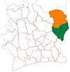
Assuéfry
Appearance
Assuéfry
Assuéffry | |
|---|---|
Town, sub-prefecture, and commune | |
| Coordinates: 7°42′N 2°59′W / 7.700°N 2.983°W | |
| Country | |
| District | Zanzan |
| Region | Gontougo |
| Department | Tanda |
| Population (2014)[1] | |
• Total | 30,406 |
| Time zone | UTC+0 (GMT) |
Assuéfry (also spelled Assuéffry) is a town in the far east of Ivory Coast. It is a sub-prefecture of Transua Department in Gontougo Region, Zanzan District. Assuéfry is also a commune.
In 2014, the population of the sub-prefecture of Assuéfry was 30,406.[2]
Villages
[edit]The twenty seven villages of the sub-prefecture of Assuéfry and their population in 2014 are:[2]
- Abokro (394)
- Adandia (1 705)
- Adiamara (564)
- Adiopènan (174)
- Amonkobénankro (793)
- Assuamakro (212)
- Assuéfry (9 759)
- Bouakro (130)
- Datékro (469)
- Hiango (1 306)
- Kassabi (298)
- Kékréni (1 787)
- Kotokuini (214)
- Kouam-Dari (491)
- Kouassi-Séranou (1 241)
- Mantoukoua (1 003)
- Mérékou (1 107)
- N'gam (1 008)
- Siédja (1 000)
- Yomankro (1 334)
- Batoutié Foumassa (229)
- Bossomkuikro (1 233)
- Dadiassé (1 414)
- Kotokoua (144)
- Yakassé-Akidom (927)
- Yao Dongokro (375)
- Yomian (1 095)
Notes
[edit]- ^ "Côte d'Ivoire". geohive.com. Retrieved 15 December 2015.
- ^ a b "RGPH 2014, Répertoire des localités, Région Gontougo" (PDF). ins.ci. Retrieved 5 August 2019.


