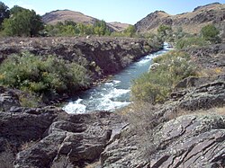
Asa (Kazakhstan)
| Mashat | |
|---|---|
 | |
| Location | |
| Country | Kazakhstan |
| Physical characteristics | |
| Mouth | Muyunkum Desert |
• coordinates | 43°55′13″N 70°12′24″E / 43.9202°N 70.2066°E |
| Length | 253 km (157 mi) |
| Basin size | 9,210 km2 (3,560 sq mi) |
The Asa (Kazakh: Аса, Asa) is a river of Kazakhstan. It vanishes in the Muyunkum Desert before reaching the river Talas. The river is 253 kilometres (157 mi) long and has a basin area of 9,210 square kilometres (3,560 sq mi).[1]
