Gunwi County
This article relies largely or entirely on a single source. (May 2018) |
Gunwi
군위군 | |
|---|---|
| Korean transcription(s) | |
| • Hangul | 군위군 |
| • Hanja | 軍威郡 |
| • Revised Romanization | Gunwi-gun |
| • McCune-Reischauer | Kunwi-gun |
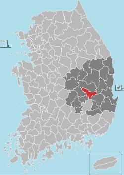
 Location in South Korea | |
| Country | |
| Region | Yeongnam |
| Administrative divisions | 1 eup, 7 myeon |
| Area | |
| • Total | 614.15 km2 (237.12 sq mi) |
| Population | |
| • Total | 34,293 |
| • Density | 55/km2 (140/sq mi) |
| • Dialect | Gyeongsang |
Gunwi County (Gunwi-gun) is a county in North Gyeongsang Province, South Korea.
References
External links
36°14′05″N 128°34′22″E / 36.2347222322°N 128.572777788°E


