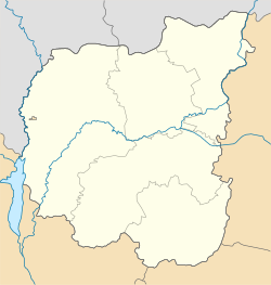
Desna, Chernihiv Oblast
Appearance
Desna
Десна | |
|---|---|
| Coordinates: 50°55′52″N 30°45′25″E / 50.93111°N 30.75694°E | |
| Country | |
| Region | Chernihiv Oblast |
| District | Kozelets Raion |
| Town status | 1960 |
| Government | |
| • Town Head | Yuriy Ostashevskyi |
| Area | |
• Total | 0.08 km2 (0.03 sq mi) |
| Elevation | 125 m (410 ft) |
| Population (2020) | |
• Total | |
| Time zone | UTC+2 (EET) |
| • Summer (DST) | UTC+3 (EEST) |
| Postal code | 17024 |
| Area code | +380 4646 |
| Website | http://rada.gov.ua/ |
Desna (Template:Lang-uk) is an urban-type settlement in Kozelets Raion, Chernihiv Oblast in northern Ukraine.[2] The town's population was 7,180 as of the 2001 Ukrainian Census.[2] Current population: 7,372 (2020 est.)[3] It is named after the Desna River which flows through the settlement.
The town houses a major military training center (169th Training Centre) of the Ukrainian Ground Forces.
References
- ^ "Desna (Chernihiv Oblast, Kozelets Raion)". weather.in.ua. Retrieved 26 March 2013.
- ^ a b "Desna, Khmelnytskyi Oblast, Kozelets Raion". Regions of Ukraine and their Structure (in Ukrainian). Verkhovna Rada of Ukraine. Archived from the original on 4 March 2016. Retrieved 26 March 2013.
- ^ Чисельність наявного населення України на 1 січня 2020 року / Population of Ukraine Number of Existing as of January 1, 2020 (PDF) (in Ukrainian and English). Kyiv: State Statistics Service of Ukraine. Archived (PDF) from the original on 28 September 2023.
External links
 Media related to Category:Desna (Kozeletskyi Raion) at Wikimedia Commons


