Roxby Hall
| Roxby Hall | |
|---|---|
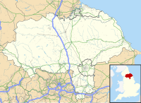
| North Yorkshire, England | |
 Only surviving wall fragment | |
| Coordinates | 54°32′06″N 0°49′25″W / 54.535000°N 0.823700°W |
| Grid reference | grid reference SO716927 |
| Type | Castle or manor house |
| Site information | |
| Open to the public | Yes |
| Condition | Ruined |
| Site history | |
| In use | late 13th century-1632 |
Roxby Hall (or Rousby Hall) is a former manor house or castle in the town of Roxby, North Yorkshire, England. Only one ruined corner and earthworks of Roxby Hall remains in a field adjacent to St. Nicholas’s Church[1]
History
Roxby Hall was supposedly built on pre-13th century pasture land during the late 13th century. It was mostly replaced and rebuilt during the 1540s and the 1560s by Sir Richard Cholmley (1516-1583). During the early 17th century, Roxby Hall was abandoned and by around 1632, the front wings, the east back wing, part of the main block and an outbuilding were demolished. By 1652, only the wall corner was left standing.[1][2][3] The earthworks south and west of the site were partially destroyed when the site was reverted to pasture after 1652.[1]
References
- ^ a b c Young, George (1817). A history of Whitby, and Streoneshalh abbey; with a statistical survey of the vicinity. p. 731.
- ^ Jackson, M. J., 2001, Castles of North Yorkshire (Carlisle), p. 95
- ^ Swan, V. G. & Mackay, A., 'From Cornwall to Caithness: Some Aspects of British Field Archaeology.' in Roxby Hill, Thornton Dale: the lost village of Roxby?, (1989), 183-195

