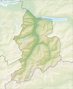
Klöntalersee
| Klöntalersee | |
|---|---|
 | |
 map | |
| Location | Canton of Glarus |
| Coordinates | 47°1′32″N 8°58′50″E / 47.02556°N 8.98056°E |
| Primary inflows | Chlü |
| Primary outflows | Löntsch |
| Basin countries | Switzerland |
| Surface area | 3.3 km2 (1.3 sq mi) |
| Max. depth | 49 m (161 ft) |
| Surface elevation | 848 m (2,782 ft) |
| Settlements | Seerüti, Vorauen |
Klöntalersee is a natural lake in the canton of Glarus, Switzerland and covers the major part of the Klöntal valley floor. Since 1908, it has been used as a reservoir for electricity production. The dam's construction substantially increased the lake's volume.
Klöntalersee is drained by the Löntsch, a left tributary of the Linth.

See also
External links
 Media related to Klöntalersee at Wikimedia Commons
- Karin Marti-Weissenbach: Klöntal in German, French and Italian in the online Historical Dictionary of Switzerland, 2006-02-28.

