Lago di Lucendro
| Lago di Lucendo | |
|---|---|
 | |
| Location | Ticino |
| Coordinates | 46°33′43″N 8°32′31″E / 46.56194°N 8.54194°E |
| Catchment area | 7.05 km2 (2.72 sq mi) |
| Basin countries | Switzerland |
| Surface area | 0.54 km2 (0.21 sq mi) |
| Max. depth | 96 m (315 ft) |
| Water volume | 25×106 m3 (880×106 cu ft) |
| Surface elevation | 2,134.50 m (7,003.0 ft) |
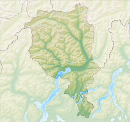
Lago di Lucendo is a reservoir at the St. Gotthard Pass in the municipality of Airolo of the canton of Ticino, Switzerland. The dam Lucendro with a height of 73 m was completed in 1947.
See also
![]() Media related to Lago di Lucendro at Wikimedia Commons
Media related to Lago di Lucendro at Wikimedia Commons

