Jump to content

Shepley Hill

Coordinates: 42°36′36″N 71°33′33″W / 42.61009°N 71.55923°W / 42.61009; -71.55923
From Wikipedia, the free encyclopedia

This is an old revision of this page, as edited by Gjs238 (talk | contribs) at 02:34, 16 November 2020 (removed Category:Landforms of Middlesex County, Massachusetts; added Category:Mountains of Middlesex County, Massachusetts using HotCat). The present address (URL) is a permanent link to this revision, which may differ significantly from the current revision.

Shepley Hill
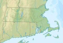
Shepley Hill is located in Massachusetts
Shepley Hill
Shepley Hill
Highest point
Elevation351 ft (107 m)
Coordinates42°36′36″N 71°33′33″W / 42.61009°N 71.55923°W / 42.61009; -71.55923

Shepley Hill is a summit in the U.S. state of Massachusetts.[1] The elevation is 351 feet (107 m).[1]

The hill was named as early as the 1670s after the local Shepley family.[2][1]

References

  1. ^ a b c U.S. Geological Survey Geographic Names Information System: Shepley Hill
  2. ^ Green, Samuel Abbott (1912). The Natural History and the Topography of Groton, Massachusetts: Together with Other Matter Relating to the History of the Town. p. 55.