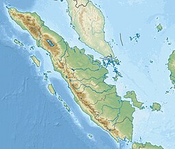
Lake Ranau
Appearance
This article needs additional citations for verification. (November 2006) |
| Ranau | |
|---|---|
 Lake Ranau in August 1926 | |
| Location | South Sumatra and Lampung, Indonesia |
| Coordinates | 4°51′45″S 103°55′50″E / 4.86250°S 103.93056°E |
| Type | Tectonic/ volcanic |
| Primary inflows | Warkuk River |
| Primary outflows | Komering River |
| Basin countries | Indonesia |
| Surface area | 125.9 km2 (48.6 sq mi) |
| Average depth | 174 m (571 ft)[1] |
| Max. depth | 229 m (751 ft) |
| Water volume | 21.95 km3 (17,800,000 acre⋅ft) |
| Surface elevation | 540 m (1,770 ft) |
Lake Ranau (Indonesian: Danau Ranau) is a Pleistocene volcanic[2] crater lake in Sumatra, Indonesia. It is located at 4°51′45″S 103°55′50″E / 4.86250°S 103.93056°E.
See also
Notes
Wikimedia Commons has media related to Lake Ranau.
- ^ Average depth calculated by dividing volume by surface area.
- ^ https://volcano.si.edu/volcano.cfm?vn=261251


