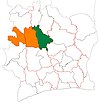
Kongasso
Kongasso
Kongaso | |
|---|---|
Town, sub-prefecture, and commune | |
| Coordinates: 7°49′N 6°5′W / 7.817°N 6.083°W | |
| Country | |
| District | Woroba |
| Region | Béré |
| Department | Kounahiri |
| Population (2014)[1] | |
| • Total | 35,642 |
| Time zone | UTC+0 (GMT) |
Kongasso (also spelled Kongaso) is a town in central Ivory Coast. It is a sub-prefecture and commune of Kounahiri Department in Béré Region, Woroba District. In 2014, the population of the sub-prefecture of Kongasso was 35,642.[2]
Villages[edit]
The eighteen villages of the sub-prefecture of Kongasso and their population in 2014 are:[2]
- Boaka (3 739)
- Bourounon (2 335)
- Fouanga (2 705)
- Gbaziasso (1 555)
- Gbéma (1 651)
- Guéasso (2 166)
- Kabakoro (196)
- Kavagouma (1 555)
- Kongasso (4 714)
- Korokopla (3 463)
- Kounadidougou (480)
- Tialouma (831)
- Tiénigbé (2 120)
- Tofesso (1 651)
- Togbasso (1 954)
- Toubalo (2 659)
- Tulé (1 868)
Notes[edit]
- ^ "Côte d'Ivoire". geohive.com. Retrieved 14 December 2015.
- ^ a b "RGPH 2014, Répertoire des localités, Région Béré" (PDF). ins.ci. Retrieved 5 August 2019.


