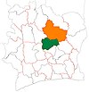
Krofoinsou
Appearance
Krofoinsou
Krofensou | |
|---|---|
Town and sub-prefecture | |
| Coordinates: 7°57′N 5°15′W / 7.950°N 5.250°W | |
| Country | |
| District | Vallée du Bandama |
| Region | Gbêkê |
| Department | Botro |
| Population (2014)[1] | |
| • Total | 11,948 |
| Time zone | UTC+0 (GMT) |
Krofoinsou (also spelled Krofensou) is a town in central Ivory Coast. It is a sub-prefecture of Botro Department in Gbêkê Region, Vallée du Bandama District.
Krofoinsou was a commune until March 2012, when it became one of 1126 communes nationwide that were abolished.[2]
In 2014, the population of the sub-prefecture of Krofoinsou was 11,948.[3]
Villages
[edit]The 14 villages of the sub-prefecture of Krofoinsou and their population in 2014 are:[3]
- Allakro (183)
- Ballékro (370)
- Kouabouhansou (359)
- Kouakou Krémékro (511)
- Krofoinsou (2 031)
- Lougbonou-Totokrakro (681)
- Namouékoungba (595)
- N'gatta-Kongouékro (417)
- N'gorankro (526)
- N'guessan-Kankro (1 407)
- Plahankro (843)
- Pliké-Somolo (554)
- Pliké-Totokro (2 699)
- Tiéviessou (772)
Notes
[edit]- ^ "Côte d'Ivoire". geohive.com. Retrieved 14 December 2015.
- ^ "Le gouvernement ivoirien supprime 1126 communes, et maintient 197 pour renforcer sa politique de décentralisation en cours", news.abidjan.net, 7 March 2012.
- ^ a b "RGPH 2014, Répertoire des localités, Région Gbêkê" (PDF). ins.ci. Retrieved 5 August 2019.


