Lake Taminah
Appearance
| Lake Taminah | |
|---|---|
| Location | Grand Teton National Park, Teton County, Wyoming, US |
| Coordinates | 43°42′28″N 110°48′23″W / 43.70778°N 110.80639°W[1] |
| Type | Glacial Lake |
| Basin countries | United States |
| Max. length | .30 mi (0.48 km) |
| Max. width | .10 mi (0.16 km) |
| Surface elevation | 9,055 ft (2,760 m)[2] |
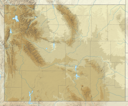
Lake Taminah is located in Grand Teton National Park, in the U. S. state of Wyoming.[2] This alpine lake is a .5 miles (0.80 km) northeast of Mount Wister and a little over a half mile south of Cloudveil Dome Lake Taminah lies within Avalanche Canyon and is .5 miles (0.80 km) east and almost 1,000 feet (300 m) lower in elevation than Snowdrift Lake. Lake Taminah is along a route often taken by climbers attempting to gain access to various mountain peaks, though the trails are not maintained.[3] Near the outlet from Lake Taminah lies Shoshoko Falls, which later flows into Taggart Creek.[2]
References
- ^ "Lake Taminah". Geographic Names Information System. United States Geological Survey, United States Department of the Interior. Retrieved 2012-02-05.
- ^ a b c Grand Teton, WY (Map). Topoquest (USGS Quads). Retrieved 2012-02-05.
- ^ Ortenburger, Leigh N.; Reynold G. Jackson (November 1, 1996). A Climbers Guide to the Teton Range. Mountaineers Books. p. 50. ISBN 0-89886-480-1.

