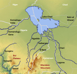
Ngadda River
Appearance

The Ngadda River is a river in Nigeria that flows into Lake Chad and the Chad Basin. The Alau dam built on the river has interfered with fertile seasonal floodplains in the region of Maiduguri.[1]
References
- ^ Thambyapillay, G. G. R. (1993-05-13). "Drought chronology dating in the lake Chad basin (Nigeria command)". Colloques et séminaires - Institut français de recherche scientifique pour le développement en coopération. Paris: ORSTOM Soil Research Centre: 31–61.
12°40′N 13°50′E / 12.667°N 13.833°E
