Moquegua Basin
Appearance
| Moquegua Basin | |
|---|---|
| Cuenca Moquegua | |
| Coordinates | 16°48′S 70°48′W / 16.800°S 70.800°W |
| Etymology | City of Moquegua, Peru |
| Location | Western South America |
| Country | |
| State(s) | Department of Moquegua |
| Cities | Moquegua |
| Characteristics | |
| On/Offshore | Onshore |
| Part of | Circum-Pacific forearc basins |
| Hydrology | |
| Sea(s) | Eastern Pacific Ocean |
| River(s) | Osmore River |
| Geology | |
| Basin type | Forearc basin |
| Orogeny | Andean |
| Age | Cenozoic |
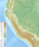
Moquegua Basin is a sedimentary basin in southernmost Peru. Sedimentary rocks of the basin, including those of Moquegua Group,[1] crop out in the Central Depression makes up part of the sedimenty fill of the basin.[2] The basement of the basin is made of rocks older than the Cenozoic.[2]
Despite being close to the Pacific Ocean Moquegua Basin appear to have been unaffected by the Oligo-Miocene marine transgression that affected many other basins of western South America such as nearby Pisco Basin.[3] Concurrent with Andean uplift it is thought that the basin went from having a “balanced basin-fill” between Oligocene and Middle Miocene having a “overfilled basin-fill” from the Middle Miocene to the present.[1]
References
[edit]- ^ a b Alván, Aldo; Ramírez, Katerine; von Eynatten, Hilmar; Dunkl, István; Jacay, Javier; Bertone, Gabriela (2017). "Evolución Geológica de las Cuencas de Antearco del Sur de Perú (Moquegua y Camaná-Mollendo): Proveniencia Sedimentaria y Análisis de Facies en Rocas Cenozoicas". Boletín de la Sociedad Geológica del Perú (in Spanish). 112: 053–077.
- ^ a b Salazar, Esteban; Bustamante, Yacory F.; Sánchez, Elvis A.; Mamani, Mirian I. (2020). "Arquitectura estratigráfica, paleogeografía y proveniencia sedimentaria de las rocas cenozoicas del sur de Perú (Tacna, 18° S)". Andean Geology. 47 (2). National Geology and Mining Service: 351–383. doi:10.5027/andgeoV47n2-3131.
- ^ Macharé, José; Devries, Thomas; Barron, John; Fourtanier, Élisabeth (1988). "Oligo-Miocene transgression along the Pacifie margin of South America: new paleontological and geological evidence from the Pisco basin (Peru)" (PDF). Geódynamique. 3 (1–2): 25–37. Retrieved 2020-03-09.


