Warroad–Sprague Border Crossing
| Warroad–Sprague Border Crossing | |
|---|---|
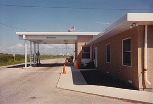
 Former US Border Inspection Station at Warroad, MN as seen in 1998 | |
| Location | |
| Country | United States; Canada |
| Location |
|
| Coordinates | 48°59′56″N 95°22′34″W / 48.998994°N 95.376154°W |
| Details | |
| Opened | 1901 |
| US Phone | (218) 386-2796 |
| Website https://www.cbp.gov/contact/ports/warroad-minnesota-3423 | |
The Warroad–Sprague Border Crossing connects the city of Warroad, Minnesota and community of Sprague, Manitoba on the Canada–United States border.
This crossing is the only port of entry between Manitoba and Minnesota with 24-hour service and is connected by Minnesota State Highway 313 in Roseau County on the American side and Manitoba Highway 12 in the Rural Municipality of Piney on the Canadian side. These highways form part of MOM's Way between Thunder Bay, Ontario and Ste. Anne, Manitoba. The road crossing is accompanied by an adjacent rail crossing; however, the track on the U.S. side is isolated from its national rail network and used solely by Canadian National Railway to circumvent Lake of the Woods between Sprague, Manitoba and Rainy River, Ontario.[1]
The Warroad–Sprague crossing is the easternmost along the 2,030-kilometer (1,260-mile) part of the Canada-U.S. border on the 49th parallel north between the Strait of Georgia and nearby Lake of the Woods.[2] It is frequently used by U.S. residents when traveling to and from Northwest Angle, an enclave of Minnesota that can only be accessed from Manitoba when traveling by land.
The U.S. replaced its border station in 2010 with an elaborate 3,700-square-meter (40,000-square-foot) facility that won architectural design awards.[which?][3] The new facility is approximately one kilometer (0.6 miles) south of the previous border inspection station. Canada last replaced the Sprague border station in 1973.[citation needed]
See also
References
- ^ Shaffer, David (4 August 2014). "Canadian crude taking rail through northern Minnesota". Star Tribune. Retrieved 14 May 2020.
- ^ Jacobs, Frank (28 November 2011), "The Not-So-Straight Story of the U.S.-Canadian Border", New York Times, retrieved 13 May 2020
- ^ Mays, Vernon (November 10, 2010). "Warroad Land Port of Entry". Architect Magazine- the Journal of the American Institute of Architects. Retrieved 16 January 2017.
