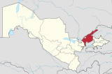
Ohangaron District
Ohangaron | |
|---|---|
| Ohangaron tumani | |
| Country | Uzbekistan |
| Region | Tashkent Region |
| Capital | Ohangaron |
| Established | 1929 |
| Area | |
| • Total | 3,190 km2 (1,230 sq mi) |
| Population | |
| • Total | 78 100 |
| Time zone | UTC+5 (UZT) |
Ohangaron is a raion (district) of Tashkent Region in Uzbekistan. The capital lies at Ohangaron.
Settlements
There are one city (Ohangaron) and eight villages (Birlik, Doʻstlik, Ozodlik, Susam, Telov, Uvak, Qoraxitoy, Qurama).[1]
Population
78 100 people.

