Rivière de Cayenne
Appearance
| Rivière de Cayenne | |
|---|---|
 | |
 | |
| Location | |
| Country | France |
| Region | French Guiana |
| Physical characteristics | |
| Mouth | Atlantic Ocean |
• coordinates | 4°55′23″N 52°20′56″W / 4.923°N 52.3489°W |
| Length | 44 km (27 mi) |
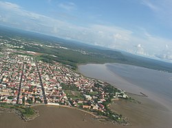
The Rivière de Cayenne ("Cayenne River") is a river in French Guiana, formed by the Rivière des Cascades and the Tonnegrande. It flows into the Atlantic Ocean near the city of Cayenne, forming an estuary about 2 km long. It is 43.7 km (27.2 mi) long, including its upper course Rivière des Cascades.[1]
The river featured prominently in both the movie and the book Papillon by Henri Charrière.
References
