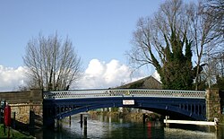
Osney Bridge
Osney Bridge | |
|---|---|
 Osney Bridge looking north from Osney Island | |
| Coordinates | 51°45′10″N 1°16′23″W / 51.752694°N 1.273093°W |
| Carries | A420 road, Thames Path |
| Crosses | River Thames |
| Locale | Oxford |
| Maintained by | Oxfordshire County Council |
| Characteristics | |
| Design | arch |
| Material | Iron |
| Height | 7 feet 6 inches (2.29 m)[1] |
| No. of spans | 1 |
| History | |
| Opened | 1889 |
| Location | |
 | |
Osney Bridge is a road bridge across the River Thames in Oxford, England, built in 1888 to replace a stone bridge which collapsed in 1885.[2] It carries the Botley Road (A420) from Botley into Oxford. The Thames Path crosses the river on this bridge, just above Osney Lock.
The original bridge was probably built by the monks of Osney Abbey, to carry the main road across the millstream of Osney Mill west from the island then known as Osney.[3] By the early 17th century it was a three arch stone construction. In 1790 the millstream became the main navigation channel of the river, and the bridge became a serious obstruction to navigation by the mid 19th century. In 1885 the central arch collapsed leaving massive piers[4]
Osney Bridge has the lowest headroom (less than 7' 6") of any across the navigable Thames, and as such limits the size of boats that can travel past it without having to be removed from the water and placed upstream of the bridge.
Whereas some[5] are happy with the restriction: "I would be sorry to see it changed. The river above here is special and I would not want to see boats any larger than those currently using it", others argue that the bridge should be raised to accommodate taller boats. Since the upper reaches of the River Thames will in due course link again with the Gloucester & Sharpness Ship Canal via the Stroudwater Canal and the Thames & Severn Canal (the latter two currently incomplete in need of restoration),[6] the Osney Bridge would seem an unacceptable obstacle to the growing popularity of canal and river navigation.
See also
- Crossings of the River Thames
- Botley Bridge over Seacourt Stream
- Bulstake Bridge over Bulstake Stream
References
- ^ "Bridge heights on the River Thames". River Thames Alliance. Archived from the original on 24 January 2008. Retrieved 14 May 2009.
- ^ Eade, John (2005). "Where Thames Smooth Waters Glide". Retrieved 14 May 2009.
- ^ Crossley, Alan; Elrington, C.R. (eds.); Chance, Eleanor; Colvin, Christina; Cooper, Janet; Day, C.J.; Hassall, T.G.; Selwyn, Nesta (1979). A History of the County of Oxford, Volume 4: Communications. Victoria County History.
{{cite book}}:|first2=has generic name (help) - ^ Thacker, Fred. S. (1968) [1920]. The Thames Highway: Volume II a history of the locks and weirs. Vol. 2. Newton Abbot: David & Charles. ISBN 9780715342336. OCLC 55209571.
- ^ "WHERE THAMES SMOOTH WATERS GLIDE" [1]
- ^ Canal system map [2]

