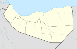
El Bardale
Appearance
El Bardale | |
|---|---|
Locality | |
| Coordinates: 9°48′00″N 43°29′00″E / 9.80000°N 43.48333°E | |
| Country | |
| Region | Maroodi Jeex |
| District | Gabiley District |
| Time zone | UTC+3 (EAT) |
El Bardale (Somali: Ceel Bardaale) is a town located in northwestern Gabiley District in the Maroodi Jeex region of Somaliland.[1]
Overview
It is an agricultural town. Most of the residents are primarily farmers that raise livestock animals such as camels, cattle, goats, sheep and even chickens.[2]
Demographics
The total population of this town is 3,547. The town is primarily inhabited by people from the Somali ethnic group and is wholly dominated by the Ali Jibril (Reer Hareed) sub-clan of the Jibril Abokor sub-division of the Habar Awal clan.[3][4]
References
- ^ https://mapcarta.com/12475052
- ^ "Gabiley Travel Guide". World66.com. Archived from the original on 30 September 2007. Retrieved 12 April 2015.
- ^ http://www.refworld.org/docid/3ae6ab704.html
- ^ Phillips, Sarah. "Political Settlements and State Formation: The Case of Somaliland" (PDF). Archived from the original (PDF) on 2 February 2017. Retrieved 4 June 2017.

