Chipoka
Chipoka | |
|---|---|
| Coordinates: 13°58′S 34°30′E / 13.967°S 34.500°E | |
| Country | |
| Region | Central Region |
| District | Salima District |
| Population (2018 Census[1]) | |
| • Total | 6,395 |
| Climate | Aw |
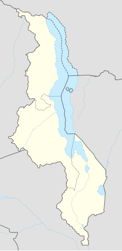
Chipoka is a town located in the Central Region district of Salima, in Malawi. It is one of the main ports on Lake Malawi and is the closest port to the capital city of Lilongwe. Chipoka is located on the western shore of Kasangha Bay across from Cape Maclear.
Nearby towns and villages include Chaseta (7.8 mi (12.6 km)), Ndembo (7.7 mi (12.4 km)), Kalombola (5.6 mi (9.0 km)), Lowe (5.6 mi (9.0 km)), Mazenjele (5.6 mi (9.0 km)), Chikanda (4.9 mi (7.9 km)), Milala (4.9 mi (7.9 km)), Mkangawi (4.9 mi (7.9 km)), Mzembela (4.9 mi (7.9 km)), Pemba (4.9 mi (7.9 km)) and Kachindamoto(11.7 mi (18.8 km)).
The city has a railway station on the Sena railway, part of the Malawi Railways.
Demographics
| Year | Population[2][1] |
|---|---|
| 1998 | 3,986 |
| 2008 | 5,476 |
| 2018 | 6,395 |
References
- ^ a b "2018 Population and Housing Census Main Report" (PDF). Malawi National Statistical Office. Retrieved 25 December 2019.
- ^ World Gazetteer: Malawi: largest cities and towns and statistics of their population Archived August 4, 2008, at the Wayback Machine
13°58′S 34°30′E / 13.967°S 34.500°E

