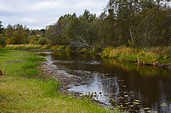
Alajõgi
Appearance
| Alajõgi | |
|---|---|
 | |
 | |
| Physical characteristics | |
| Source | |
| • location | Kõnnu Pikkjärv |
| Mouth | |
• location | Lake Peipus |
| Length | 29 km (18 mi) |
| Basin size | 150 km2 (58 sq mi) |
The Alajõgi is a river in Estonia. The river is 29 kilometers long. The river begins at Kõnnu pikkjärv, near the village of Ongassaare.
59°0′26.31″N 27°26′2.24″E / 59.0073083°N 27.4339556°E
