Alpnachstad railway station
Alpnachstad | |||||
|---|---|---|---|---|---|
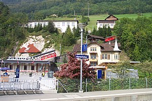
 Pilatus station seen from Brünig line platform | |||||
| General information | |||||
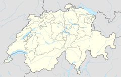
| Location | Bahnhofplatz Alpnachstad Alpnach, Obwalden Switzerland | ||||
| Coordinates | 46°57′18″N 8°16′40″E / 46.955066°N 8.277855°E | ||||
| Elevation | 436 m (1,430 ft) | ||||
| Operated by | Zentralbahn Pilatus Railway | ||||
| Line(s) | Brünig line (Zentralbahn) Pilatus Railway | ||||
| Connections | SGV on Lake Lucerne | ||||
| |||||

Alpnachstad is a Swiss railway station in the municipality of Alpnach in the canton of Obwalden. It is on the Brünig line, owned by the Zentralbahn, that links Lucerne and Interlaken, and is also the lower terminus of the Pilatus Railway, a rack railway that ascends to the summit of Pilatus.[1][2]
Alpnachstad station is one of two stations to serve Alpnach, the other being Alpnach Dorf, which is on the Brünig line some 1.5 kilometres (0.93 mi) to the south, and nearer the centre of Alpnach.[1][2]
The Pilatus Railway and Brünig line use different gauges, and there is no physical connection between the two lines. The two lines operate from platforms on opposite sides of the Bahnhofplatz, and have their own station buildings. The station is served by the following passenger trains:[3][4]
| Operator | Train Type | Route | Typical Frequency | Notes |
|---|---|---|---|---|
| Zentralbahn | Lucerne S-Bahn Line S5 |
Lucerne - Kriens Mattenhof - Horw - Hergiswil Matt - Hergiswil - Alpnachstad - Alpnach Dorf - Sarnen - Sachseln - Ewil Maxon - Giswil | 2 per hour | |
| Pilatus Railway | Alpnachstad - Ämsigen - Pilatus Kulm | 15 per day in summer |
A nearby quay on Lake Lucerne is served by shipping services of the Schifffahrtsgesellschaft des Vierwaldstättersees (SGV), providing an alternative connection to Lucerne and other lakeside communities.[5]
References
- ^ a b map.geo.admin.ch (Map). Swiss Confederation. Retrieved 2013-01-08.
- ^ a b Eisenbahnatlas Schweiz. Verlag Schweers + Wall GmbH. 2012. p. 22. ISBN 978-3-89494-130-7.
- ^ "Luzern–Brünig–Interlaken" (PDF). Bundesamt für Verkehr. Retrieved 2013-01-07.
- ^ "Alpnachstad–Pilatus" (PDF). Bundesamt für Verkehr. Retrieved 2013-01-07.
- ^ "Luzern–Alpnachstad (Vierwaldstättersee)" (PDF). Bundesamt für Verkehr. Retrieved 2013-01-07.
External links
 Media related to Alpnachstad railway station at Wikimedia Commons

