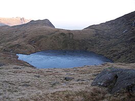
Angle Tarn (Langstrath)
Appearance
| Angle Tarn | |
|---|---|
 facing SE, towards the top of Rossett Gill and Langdale | |
| Location | Lake District |
| Coordinates | 54°27′30″N 3°10′00″W / 54.45833°N 3.16667°W |
| Type | Tarn |
| Basin countries | United Kingdom |
| Surface elevation | ~560 m |
Angle Tarn is a tarn to the north of Bowfell in the English Lake District. It drains into Langstrath Beck.
