Austefjord
Appearance
| Austefjorden | |
|---|---|
 View of the local church, at the end of the fjord | |
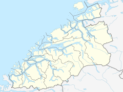
Location in Møre og Romsdal county | |
| Location | Sunnmøre, Møre og Romsdal |
| Coordinates | 62°05′14″N 6°09′39″E / 62.0871°N 6.1607°E |
| Primary inflows | Fyrdselva river |
| Primary outflows | Voldsfjorden |
| Basin countries | Norway |
| Max. length | 11 kilometres (6.8 mi) |
| Max. width | 2 kilometres (1.2 mi) |
| Settlements | Fyrde |
The Austefjorden is a fjord arm off of the Voldsfjorden in Volda Municipality in Møre og Romsdal county, Norway. The 11-kilometre (6.8 mi) long fjord lies in the Sunnmørsalpene mountains about 5 kilometres (3.1 mi) north of the mountain Eidskyrkja in the northeastern part of the municipality. The Austefjorden and the Kilsfjorden join together to form the Voldsfjorden. The village of Fyrde is located at the innermost part of the fjord. There are several small peninsulas and outcroppings that jut out into the fjord, giving the fjord a meandering S-shaped path.[1][2]
References
- ^ "Austefjorden" (in Norwegian). yr.no. Archived from the original on 13 September 2010. Retrieved 2010-09-19.
{{cite web}}: Unknown parameter|deadurl=ignored (|url-status=suggested) (help) - ^ Store norske leksikon. "Austefjorden – del av Voldafjorden" (in Norwegian). Retrieved 2013-08-15.

