Bierówka
Bierówka | |
|---|---|
Village | |
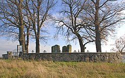
 War cemetery from 1915 | |
| Coordinates: 49°47′N 21°35′E / 49.783°N 21.583°E | |
| Country | |
| Voivodeship | Subcarpathian |
| County | Jasło |
| Gmina | Gmina Jasło |
Bierówka [bjɛˈrufka] is a village in the administrative district of Gmina Jasło, within Jasło County, Subcarpathian Voivodeship, in south-eastern Poland. It lies approximately 9 kilometres (6 mi) north-east of Jasło and 42 km (26 mi) south-west of the regional capital Rzeszów.[1]
World War II

Bierówka is the location of World War II cemetery situated at Bierowskie Doły (pictured), with unmarked mass graves of prisoners of the Szebnie concentration camp nearby, covering the entire perimeter. Notably, the old monument mentions only the Soviet prisoners of war from Szebnie. Over the course of the camp's operation some 10,000 people perished there, including Soviet POWs, Polish Jews and non-Jewish Poles as well as Ukrainians and Romani people.[2]
References
- ^ "Central Statistical Office (GUS) - TERYT (National Register of Territorial Land Apportionment Journal)" (in Polish). 2008-06-01.
- ^ Jacek Bracik, Józef Twaróg (2003). "Obóz w Szebniach (Camp in Szebnie)" (in Polish). Region Jasielski, nr 3 (39). Archived from the original (Internet Archive) on February 1, 2010. Retrieved 4 July 2013.
{{cite web}}: Italic or bold markup not allowed in:|publisher=(help); Unknown parameter|deadurl=ignored (|url-status=suggested) (help)

