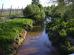
Blšanka
Appearance
You can help expand this article with text translated from the corresponding article in Czech. (July 2011) Click [show] for important translation instructions.
|
| Blšanka | |
|---|---|
 | |
 | |
| Location | |
| Country | Czech Republic |
| Physical characteristics | |
| Mouth | |
• location | Ohře |
• coordinates | 50°19′06″N 13°36′34″E / 50.3184°N 13.6094°E |
| Length | 50.8 km (31.6 mi) |
| Basin size | 483 km2 (186 sq mi) |
| Basin features | |
| Progression | Ohře→ Elbe→ North Sea |
Blšanka is a river, a right tributary of the Ohře, of the Ústí nad Labem Region in northwest Bohemia, in the Czech Republic.[1] It is 50.8 km long, and its basin area is 483 km2.[2] It flows into the Ohře near Žatec.
References
- ^ Geografie: sborník České geografické společnosti. Česká geografická společnost. 2000. Retrieved 25 July 2011.
- ^ "Charakteristiky toků a povodí ČR - Blšanka" (in Czech). VÚV TGM. Retrieved 2018-05-07.
