Jump to content

Bolberry Down

Coordinates: 50°13′54″N 3°50′36″W / 50.231694°N 3.843282°W / 50.231694; -3.843282
From Wikipedia, the free encyclopedia

This is an old revision of this page, as edited by Addbot (talk | contribs) at 02:51, 19 March 2013 (Bot: Migrating 1 interwiki links, now provided by Wikidata on d:q3641699). The present address (URL) is a permanent link to this revision, which may differ significantly from the current revision.

50°13′54″N 3°50′36″W / 50.231694°N 3.843282°W / 50.231694; -3.843282

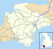
Bolberry Down is located in Devon
Bolberry Down
The location of Bolberry Down within Devon
(grid reference SX685385)
Cliff at Bolberry Down, Bolberry.
Cliffs west of Slippery Point.

Bolberry Down is a clifftop area on the coast of Devon, England. The headland of Bolt Tail lies to the west and Bolt Head and the town of Salcombe to the east. It is one of the longest coastal areas owned by the National Trust and lies within the South Devon Area of Outstanding Natural Beauty.

It offers views to Bantham Beach and Burgh Island. During the Second World War it was used as a Royal Air Force station and the old concrete buildings and disused runway can still be seen.

Bolberry Down at South Devon AONB