Boyn Ridge
Appearance

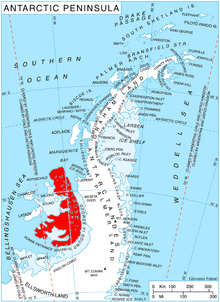
Boyn Ridge (69°7′S 71°48′W / 69.117°S 71.800°W) is the northernmost ridge of the Havre Mountains, north Alexander Island, Antarctica. Situated 5.6 km north-northwest of Satovcha Peak. Following geological work by the British Antarctic Survey, 1976–77, it was named by the UK Antarctic Place-Names Committee in 1980 after Charles Boyn, Director, Agence General Maritime, France, who superintended the building of the expedition ship Pourquoi-Pas? of the French Antarctic Expedition, 1908–10.
References
 This article incorporates public domain material from "Boyn Ridge". Geographic Names Information System. United States Geological Survey.
