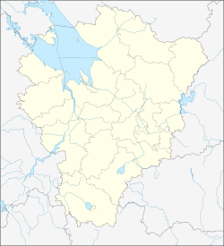
Breytovo
Breytovo
Брейтово | |
|---|---|
| Coordinates: 58°18′N 37°52′E / 58.300°N 37.867°E | |
| Country | Russia |
| Federal subject | Yaroslavl Oblast[1] |
| Administrative district | Breytovsky District[1] |
| Elevation | 109 m (358 ft) |
| Population | |
| • Total | 3,308 |
| • Capital of | Breytovsky District[1] |
| Time zone | UTC+3 (MSK |
| Postal code(s)[3] | |
| OKTMO ID | 78609411101 |
Breytovo (Template:Lang-ru) is a rural locality (a selo) and the administrative center of Breytovsky District of Yaroslavl Oblast, Russia. Population: 3,308 (2010 Census);[1] 3,710 (2002 Census);[4] 4,015 (1989 Soviet census).[5]
History
The first written sources mentioning the place and its surroundings are related to weaving crafts in ancient Russia. Breytovo is mentioned on November 17, 1613 in a book of account of the crown.[6] On February 28, 1934, the village of Breytovo was officially reunited with the neighboring village of Zaruchye, all taking the name Breytovo.[7]
When the huge Rybinsk Reservoir was built, after the construction of the Rybinsk Dam (1935-1941), Breitovo was engulfed by the water and the houses were moved.[6]
Between 1986 and 1991, Breytovo had the status of an urban village.[8]
Breitovo is also known, as well as its surrounding villages, for having been the place of breeding from the beginning of the 20th century of a pig breed, Breitovo.
References
- ^ a b c d e f g Russian Federal State Statistics Service (2011). Всероссийская перепись населения 2010 года. Том 1 [2010 All-Russian Population Census, vol. 1]. Всероссийская перепись населения 2010 года [2010 All-Russia Population Census] (in Russian). Federal State Statistics Service.
- ^ "Об исчислении времени". Официальный интернет-портал правовой информации (in Russian). June 3, 2011. Retrieved January 19, 2019.
- ^ Почта России. Информационно-вычислительный центр ОАСУ РПО. (Russian Post). Поиск объектов почтовой связи (Postal Objects Search) (in Russian)
- ^ Federal State Statistics Service (May 21, 2004). Численность населения России, субъектов Российской Федерации в составе федеральных округов, районов, городских поселений, сельских населённых пунктов – районных центров и сельских населённых пунктов с населением 3 тысячи и более человек [Population of Russia, Its Federal Districts, Federal Subjects, Districts, Urban Localities, Rural Localities—Administrative Centers, and Rural Localities with Population of Over 3,000] (XLS). Всероссийская перепись населения 2002 года [All-Russia Population Census of 2002] (in Russian).
- ^ Всесоюзная перепись населения 1989 г. Численность наличного населения союзных и автономных республик, автономных областей и округов, краёв, областей, районов, городских поселений и сёл-райцентров [All Union Population Census of 1989: Present Population of Union and Autonomous Republics, Autonomous Oblasts and Okrugs, Krais, Oblasts, Districts, Urban Settlements, and Villages Serving as District Administrative Centers]. Всесоюзная перепись населения 1989 года [All-Union Population Census of 1989] (in Russian). Институт демографии Национального исследовательского университета: Высшая школа экономики [Institute of Demography at the National Research University: Higher School of Economics]. 1989 – via Demoscope Weekly.
- ^ a b Template:Ru icon Генеральный план Брейтовского сельского поселения Ярославской области / НВЦ «Интеграционные технологии». — Долгопрудный, 2008.
- ^ Template:Ru icon Постановление ВЦИК от 01.07.1934 «Об изменениях в административном устройстве Ивановской промышленной области»
- ^ Template:Ru icon Приложение 1: Изменения в административно-территориальном устройстве субъектов Российской Федерации за 1989—2002 годы // Всероссийская перепись населения 2002 года. — Т. 1. Численность и размещение населения. — Росстат, 2004.


