Cambrian Mountains

The Cambrian Mountains (Welsh: Mynyddoedd Cambria, in a narrower sense: Elenydd) are a series of mountain ranges in Wales, reaching from, and including, the South Wales mountains of the Brecon Beacons, north Carmarthenshire and Ceredigion, the Black Mountains of eastern Wales, to Snowdonia in North Wales. They range in height up to more than 3000 feet in Snowdonia, while the southern ranges are of lesser height. They include volcanic rocks in Snowdonia, while the southern mountains are mainly of sedimentary origin, such as red sandstone and carboniferous limestone. All the ranges are popular with hillwalkers and scramblers.
Since they face the predominant westerly air stream coming in from the Atlantic ocean, they exhibit high rainfall and are the source of numerous rivers, among which the Severn river is by far the largest. It rises in central Wales.

Central Region

Originally the term "Cambrian Mountains" was applied in a general sense to most of upland Wales. Since the 1950s, its application has become increasingly (and arguably illogically) localised to the geographically homogeneous Mid Wales uplands known in the Welsh language as the Elenydd (which extend from Pumlumon to Mynydd Mallaen).
This barren and sparsely populated wilderness is often referred to affectionately as the Desert of Wales.
The highest point of the range is Pumlumon. The area includes the source of the River Severn and River Wye, and has been proposed as a National Park. It is the type of locality of the Cambrian period of the Paleozoic era (542-488Ma).
The Cambrian Mountains can also be seen to be continuous into parts of England, across the Anglo-Welsh border in parts of Shropshire, particularly around the Shropshire Hills AONB, Black Mountain (hill), Clun Forest and the Long Mynd areas.


Dams and Wind Farms
Cefn Croes, the site of a controversial wind farm project, is in the Cambrian Mountains, just south of the A44 road between Aberystwyth and Llangurig.[1], [2],[3]
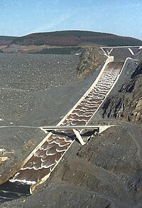
The Cambrian Mountains host the Elan Valley Reservoirs and Llyn Brianne reservoir, which provide water for the English West Midlands and for South Wales respectively. They include the Clywedog Reservoir and Nant y Moch Reservoir.

Principal Cambrian Mountain Summits
- Pen Pumlumon Fawr [Plynlimon] 752m
- Pen Pumlumon Arwystli 741m
- Pen Pumlumon Llygad-bychan 727m
- Y Garn 684m
- Pumlumon Fach 668m
- Great Rhos 660m
- Black Mixen 650m
- Drygarn Fawr 645m
- Gorllwyn 613m
- Bache Hill 610m
- Pen y Garn 610m
- Y Gamriw 604m
- Llan Ddu Fawr 593m
- Pegwn Mawr 586m
See also
- The Cambrian Way high level long-distance footpath
- Wales geography stubs
- Mountains and hills of Powys
- Geography of Gwynedd
- Geography of Conwy
- Geography of Carmarthenshire
- Geography of Ceredigion
- Rhondda Cynon Taf
- Merthyr Tydfil
- Torfaen
- Blaenau Gwent
- Mountains and hills of north Wales
- Mountains and hills of mid Wales
- Mountains and hills of south Wales
- Mountains and hills of Wales
- Mountain ranges of Europe
